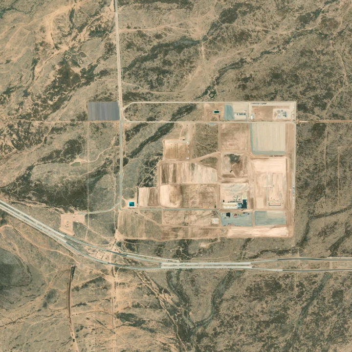
 Esri / Maxar
Boundary scopes downstream analysis.
Scope the site
Detect change and visible progress on the site—not activity on the parcel next door.
Anywhere API connects agents and applications to the physical world through small, composable geospatial primitives. Start with Anywhere.bound()—coordinates + description in, an editable GeoJSON outline out.
Editable GeoJSON · $0.02/site · Test Areas free · no credit card
Anywhere covers the contiguous United States today. Every result tells you the date of the imagery it used.
# uv pip install anywhere-sdk
from anywhere import Anywhere

anywhere = Anywhere()
result = anywhere.bound(
  coords=[[-97.5088, 30.2385]],
  target={"description": "solar farm"},
)
API primitive #1Anywhere.bound()
Addresses and coordinates live in spreadsheets, databases, PDFs, and CRMs—but points only say where to look. Anywhere.bound() turns each location into an editable 2D outline, so agents and applications can measure, compare, and compute on the places behind the records. Two cents per site.
Captured Anywhere.bound() result · editable GeoJSON
| row | location | coords | Anywhere Boundary |
|---|---|---|---|
| 1 | solar farm | [-97.51, 30.24] | |
| 2 | semiconductor plant | [-112.16, 33.78] | |
| 3 | warehouse | [-117.15, 33.94] |
from anywhere import Anywhere

anywhere = Anywhere()
result = anywhere.bound(
  coords=[[-97.5088, 30.2385]],
  target={
    "description": "solar farm",
  },
)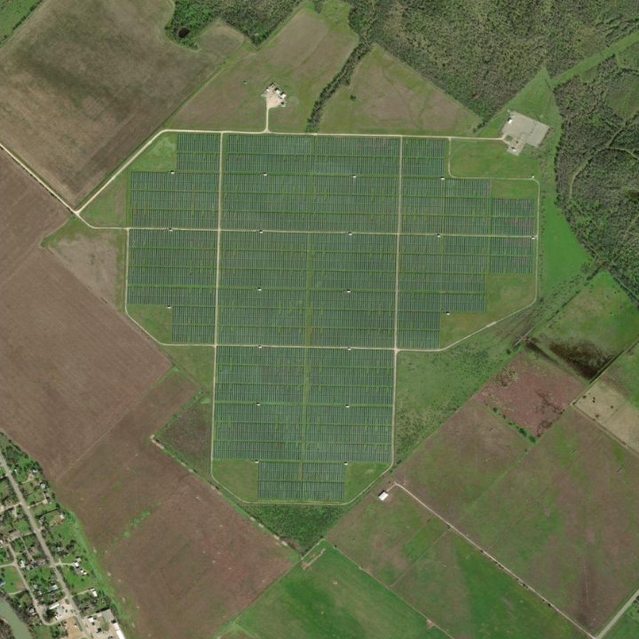 Esri / Maxar
A coordinate tells an agent where to open the image. A boundary tells it which pixels, objects, and activity belong to the site. Without that scope, downstream computer vision and spatial queries can include neighboring facilities, parcels, or activity—and return the right answer for the wrong place.
Esri / MaxarBoundary scopes downstream analysis.
Detect change and visible progress on the site—not activity on the parcel next door.
Esri / MaxarBoundary scopes downstream analysis.
Reuse the outline when you count target objects or compare the site over time.
Anywhere.bound() creates the reviewable spatial constraint. Computer-vision models use it to count and compare the right objects. Spatial databases use it to intersect the right parcels, zones, hazards, and assets.
Up to 10 Test Areas are free, four of them examples. New accounts start at $0. Every result is standard, editable GeoJSON you can add back to your records.